(07) 4658 0600

TAKE HEED OF WEED SEED

Oct 31, 2022News

When should you watch for weeds in Western Queensland?

As a region, we have experienced some amazing rain the past few years – such a joy after so many years of drought.

However, rain will also bring a greater risk of weed growth.

The best time to act on that is “now”, during the wet season.

So, what can you expect?

For many of the weeds in our region, the lack of competition from years of drought will mean weeds are the first to “take off”.

Most often weeds will grow more quickly and race to set seed well before our native species, giving them a competitive edge long-term.

In 2022, we have seen a surge in tourists, scientists, adventurers and general visitors to the region and to properties, which means regular weed monitoring and control is the only way to curb any new infestations.

You should ensure any people who come onto your properly washes their vehicles and equipment down, and only stays within agreed areas.

Why it matters

The cost of weed control is only getting more expensive.

Landholders have a responsibility to control weeds, but everyone has a responsibility to ensure that we are not increasing risk or introducing weeds onto a property or into an area.

In Desert Channels Queensland project areas, you will start to see these signs appear.

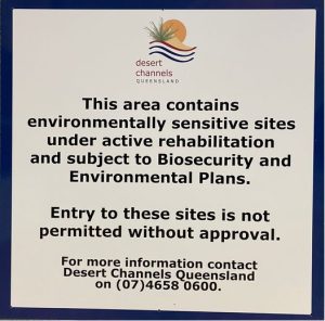
Significant public and private money is being invested to effectively manage our natural resources (soil, pasture, water, biodiversity), and while there is always an interest in these areas, it’s also important to remind visitors of their responsibilities.

Risks must be understood so investment is not undone.

Most of our weeds are easily transported by vehicles, so be careful you don’t leave a massive clean up bill for someone else next time you visit!

Photos: Fast-moving bushfires a ‘real possibility’ in Western Qld this season

The Qld Rural Fire Service is concerned fires will be more dangerous than usual.

More funding to cap and pipe bores announced for Queensland

Up to 90% of your estimated eligible project costs could be covered. 

Emu chicks hatch and reveal ‘extraordinary’ role of emu dads

A rare moment caught on camera – emu chicks hatch in Western Queensland.

Free property mapping workshop using Avenza Maps – no expertise required

Learn how to use the Avenza Maps app to navigate, collect data and map your property all without mobile reception.

Succulent ‘crack-down’ on Mother of Millions as surveys kick on

Mother of millions have spread aggressively near Blackall, but a new project will help mop it up.

WATER QUALITY

This water quality project delivers a strategic approach to ensure clean water essential for community services. It also fosters improvements in waterway health.

Waddy Trees

Occurring in isolated populations on the fringe of the Simpson Desert in inland Australia, the Waddi tree is one of the country’s rarest trees.

Invasive Cactus

Cactus weeds have become more aggressive in our region due to climate shifts, drought and rainfall variability.

HEAT

An environmental project focused on high value areas, properties that surround National Parks, or refugia that support crucial species migration in a changing climate.

GAZING AND GRAZING INTO THE FUTURE

A project dedicated to assisting the progression of the grazing industry into the future is one that deserves close attention and support from all involved in the industry. One of 10 projects under the Queensland Government’s Drought and Climate Adaptation Program...

IS DIESEL BECOMING A THING OF THE PAST?

The increased cost of diesel, along with its health and environmental issues, has opened the door for a new kind of herbicide.

SUCCESS IN THE MAKING

With the summer rain, plants are now leaping out of the ground.

THORNVILLE QUANDARY

When pastures don’t return as expected.

SEEDY BUSINESS

Sometimes, even mother nature needs a hand. Having perfected Prickly Acacia control, we have begun seeding work to “turbo charge” pasture recovery.

THE TECH SAVY DESERT RAT

iPads are not just toys for us. They’ve become critical tools in recording our data and helping us to refine our mapping.