Description
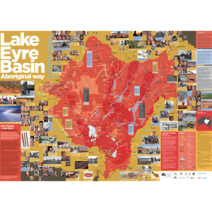
The Lake Eyre Basin Map is your go-to map of the Lake Eyre Basin, including all key features of this iconic Australian catchment.
Including the Desert Channels region, the Lake Eyre Basin covers sections large of Queensland, Northern Territory and South Australia. This map includes all towns, river systems, and major roads, and includes many national parks, property boundaries and other areas of natural significance.
It combines decades of research into the history, importance, science and cultural knowledge that impacts the future of the iconic Lake Eyre Basin and is a popular map for landholders, educators, visitors and locals alike.
…
The Lake Eyre Basin Map is a high-quality, A0 size map suitable for your shed, office, meeting room or classroom. All proceeds go into the Desert Channels Foundation to invest in the future of the Lake Eyre Basin.