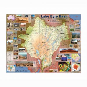
Description
The Great Artesian Basin Map is a high-quality, A0 size map of Australia’s largest groundwater basin.
It lies beneath much of the Desert Channels region, and other sections of Queensland, Northern Territory, South Australia and New South Wales.
This map showcases the wonders of the Great Artesian Basin. This important underground landform supplies water to hundreds of natural springs, outback towns and capped bores across Western Queensland, and this product tells the story of its formation, discovery and subsequent uses in agriculture, plus the latest science and knowledge.
…
The Great Artesian Basin Map is durable and suitable for your shed, office, meeting room or classroom. All proceeds go into the Desert Channels Foundation to invest in the future of the Lake Eyre Basin.